After moving into our apartment, and introducing ourselves to Lompoc a little, Chrysa and I were eager to get back to what we love, exploring and hiking. Chrysa was particularly eager to hit the dusty trail, so she spent some time on the internet, looking for some parks to visit.
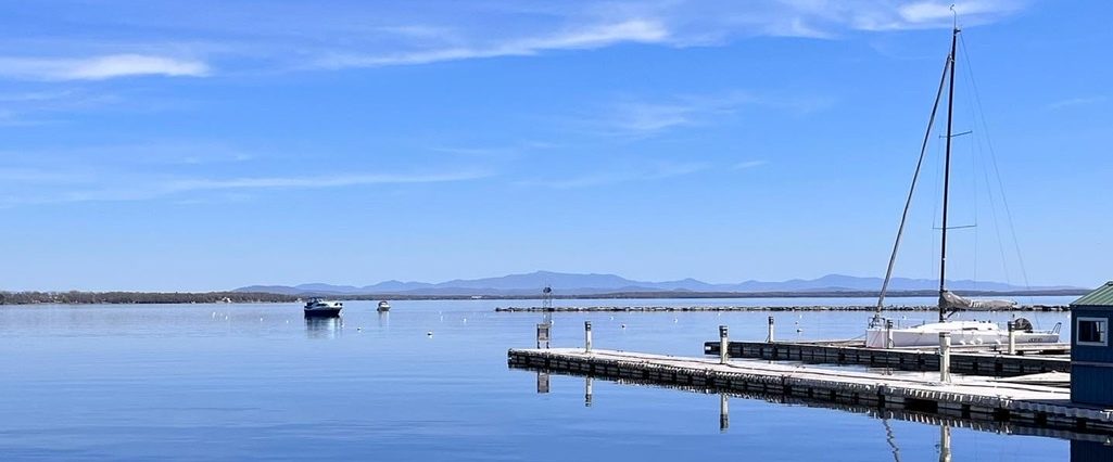
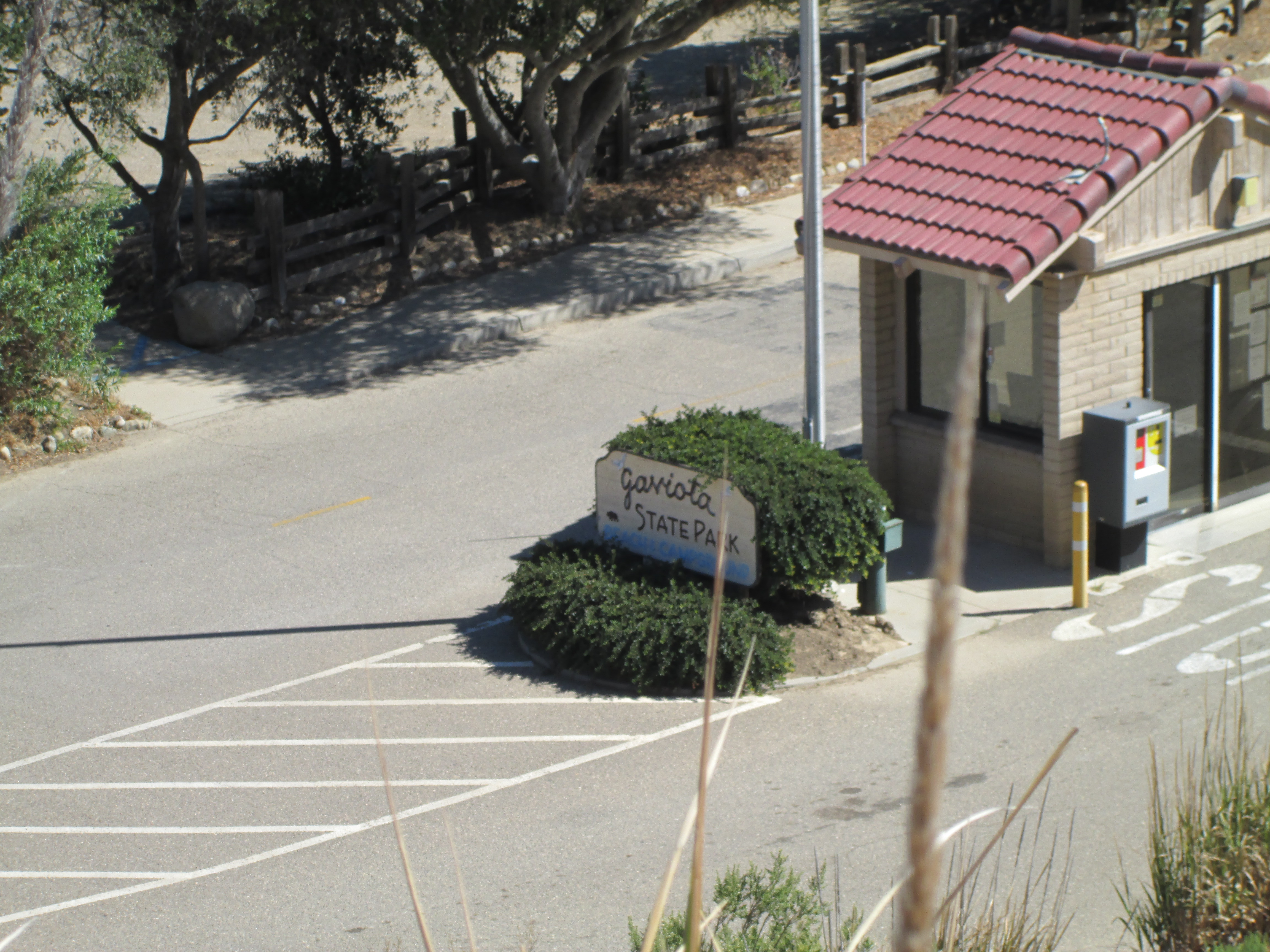
The first place she found was Gaviota State Park. Gaviota is about a 35 min drive from Lompoc down the Pacific Coast Highway. The park is located in southern Santa Barbara County right on the Pacific Coast.
We arrived at the entrance to the park and took a sharp turn up a hill to the parking area. The view before us was spectacular. In one direction was the Pacific Ocean. The sky was perfectly clear so we could see the beautiful blue waters, the sharp cliffs, the oil rigs and the Channel Islands in the distance. On the other side we could see the harsh and forbiddingly beautiful mountains. Originally we had planned to hike along the water’s edge. Unable to find a trail, we looked inland, to the wind caves.
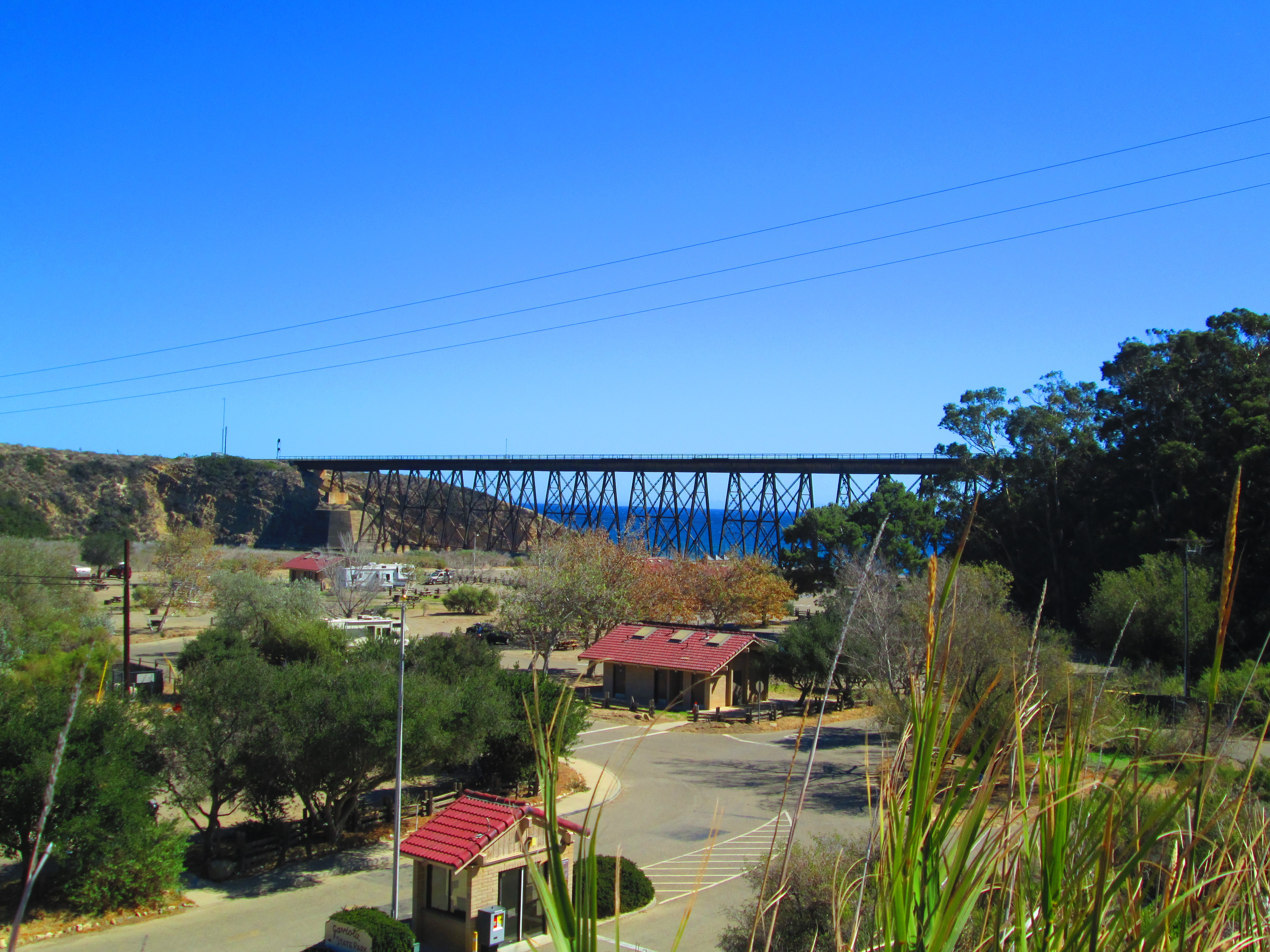
We started our hike along a paved trail that gave way to dirt. We hiked for a short while before we lost the trail entirely. We were used to the well-marked trails of the Black Hills. Unfortunately, California parks are not marked the same way. We did have a trail map that we got at the ranger station, but it was proving to be of little use. As we backtracked we came across another group of hikers struggling to find the trail. We were all heading to the wind caves so we decided to hike together. We used our map and their phone and eventually found our way.
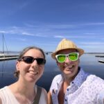
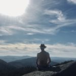
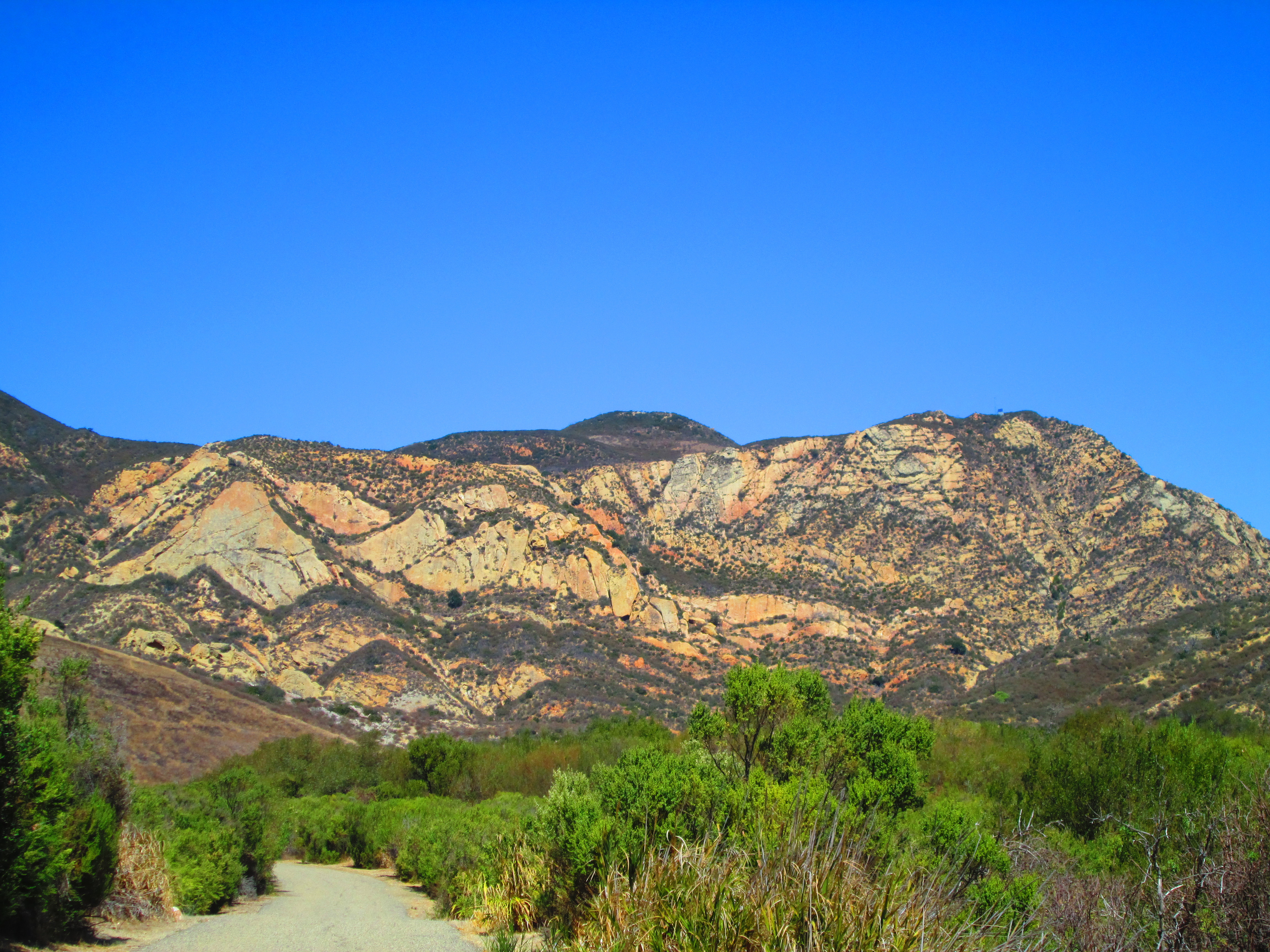
We took a break just below the caves to take some pictures, and rest, before climbing the rest of the way up. Our rest area, on higher ground, provided some great ocean views as well as views of the surrounding mountains and caves. After snapping some pictures, and talking with our new hiking buddies, Chrysa and I finished the climb to the caves.
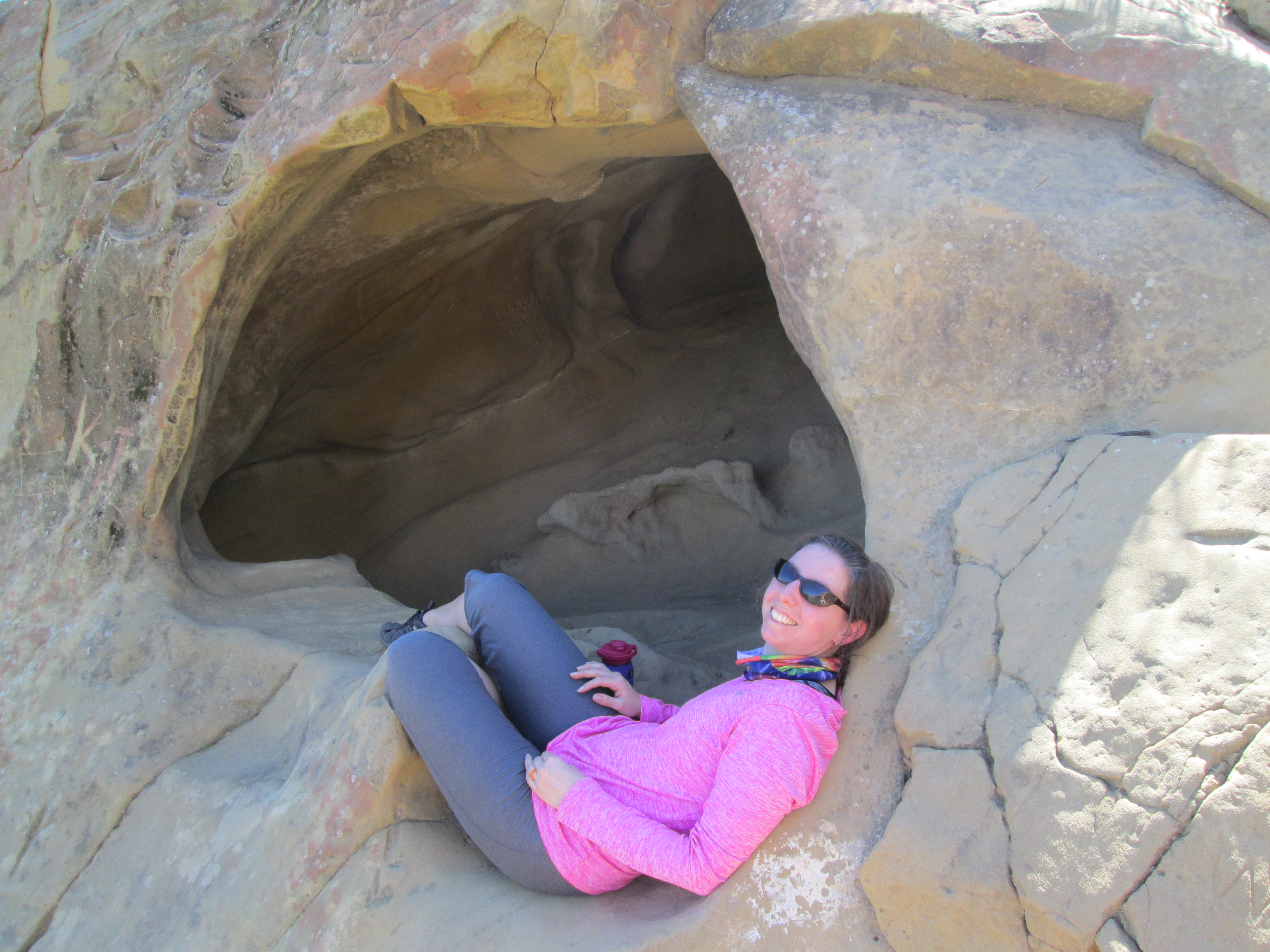
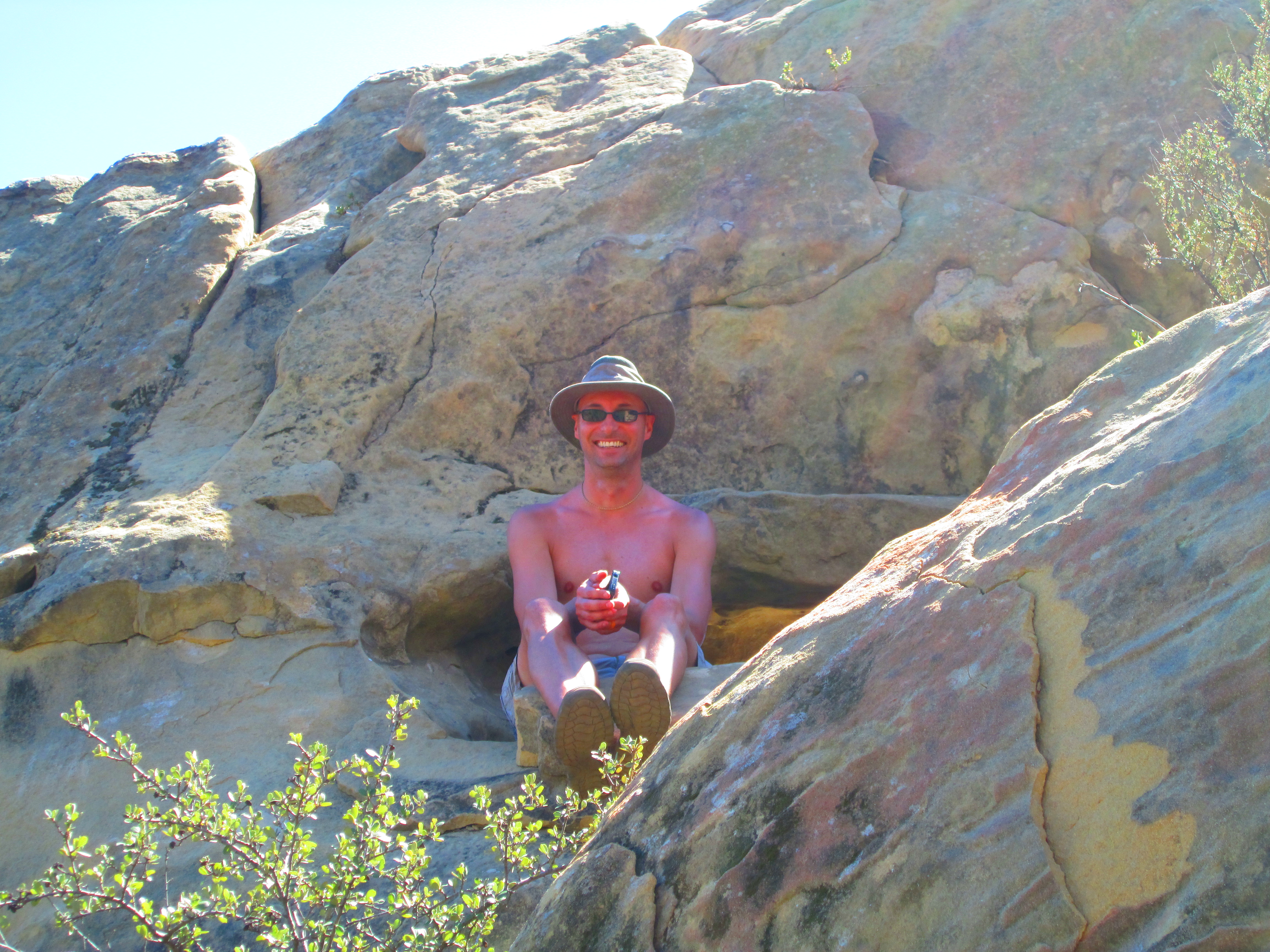
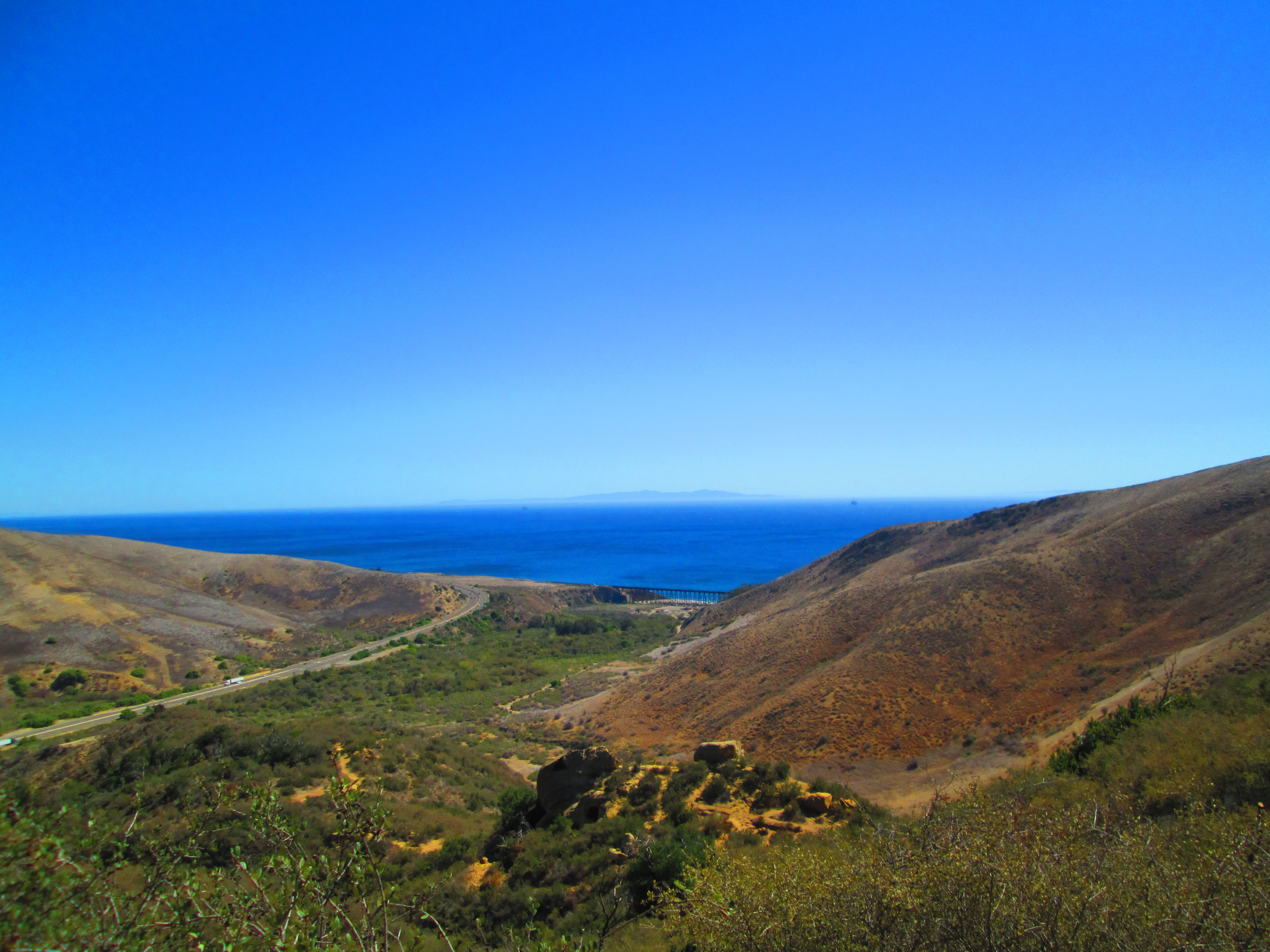
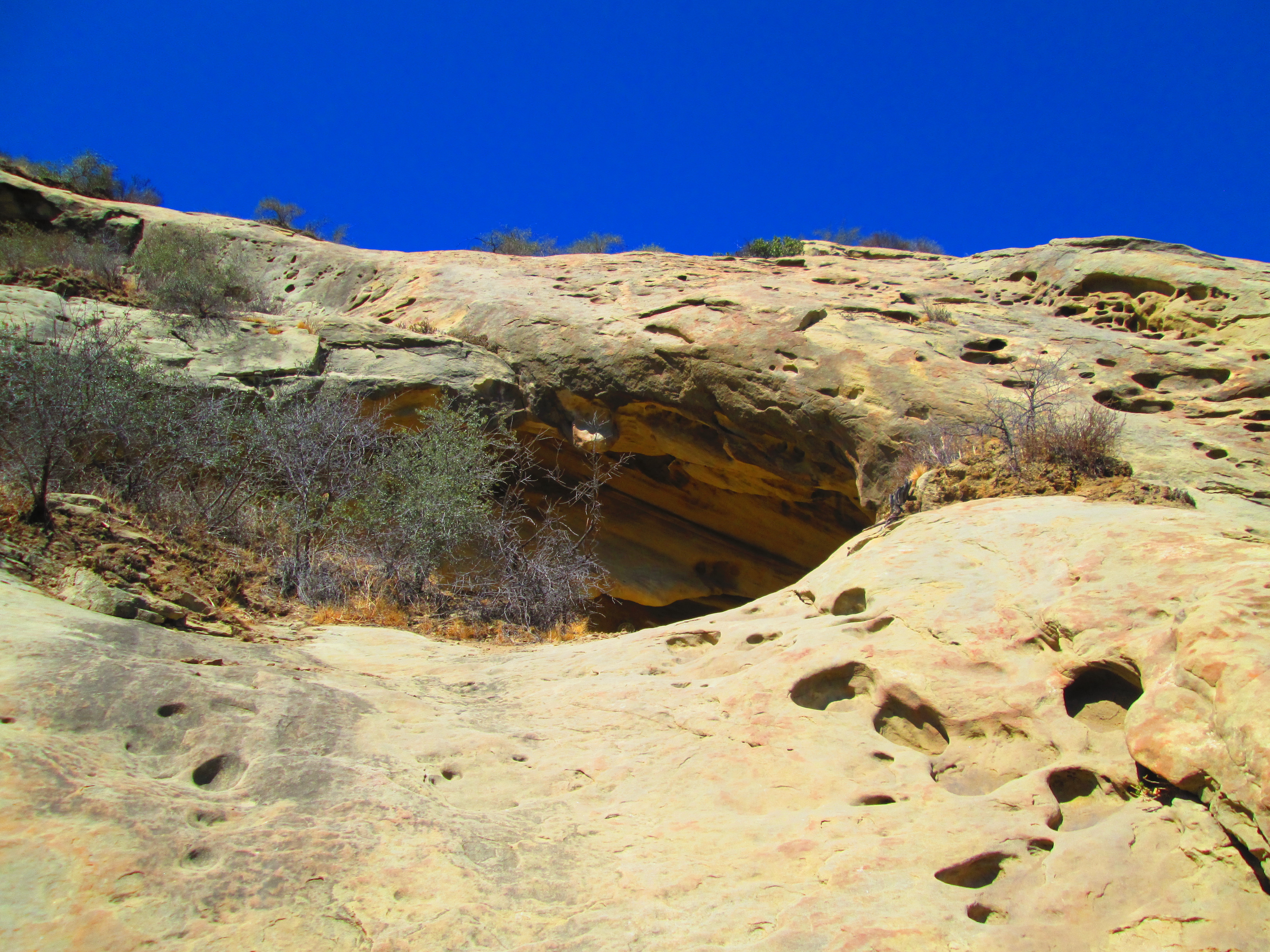
The wind caves of Gaviota are not traditional caves that you would think of. These caves are more wind eroded depressions in the rock. We got as close as we dared. You can actually climb into the caves, but that would mean a scramble up dubious footholds and handholds. Both Chrysa and I were wearing hiking sandals not suitable for that kind of work. We didn’t want to risk injury so we made the decent. We said goodbye to our new friends and finished the trek back to the Jeep.
We took some additional pictures and then made the journey back to Lompoc. We really had a nice time at Gaviota. The park is very large and there is still a whole other side of it to check out. I have since found out that there are hot springs you can hike to. We will be back!

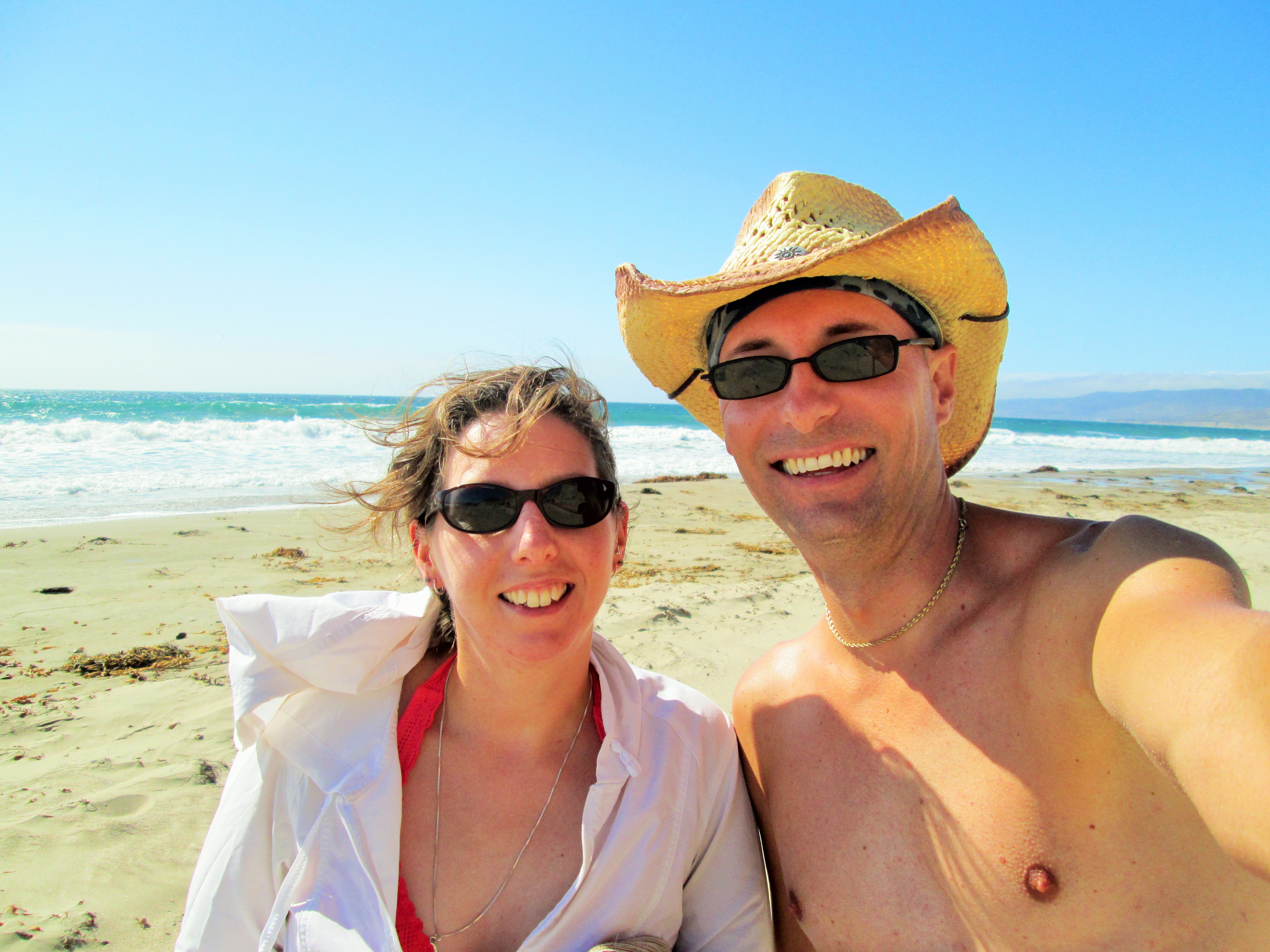
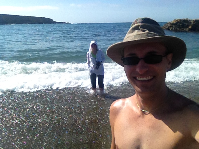
Chrysa is not usually a beach sort of chick. She doesn’t particularly like sand, and she is fair skinned, so she burns easily. In all the time we have been together, I don’t think she has ever said the words, “let’s go to the beach.” The only time I can recall her suggesting a beach trip was for our little honeymoon getaway. Even that was less beach, and more drinking and eating at the tiki bar on the pier. You can imagine my surprise when my wife suggested a beach day!
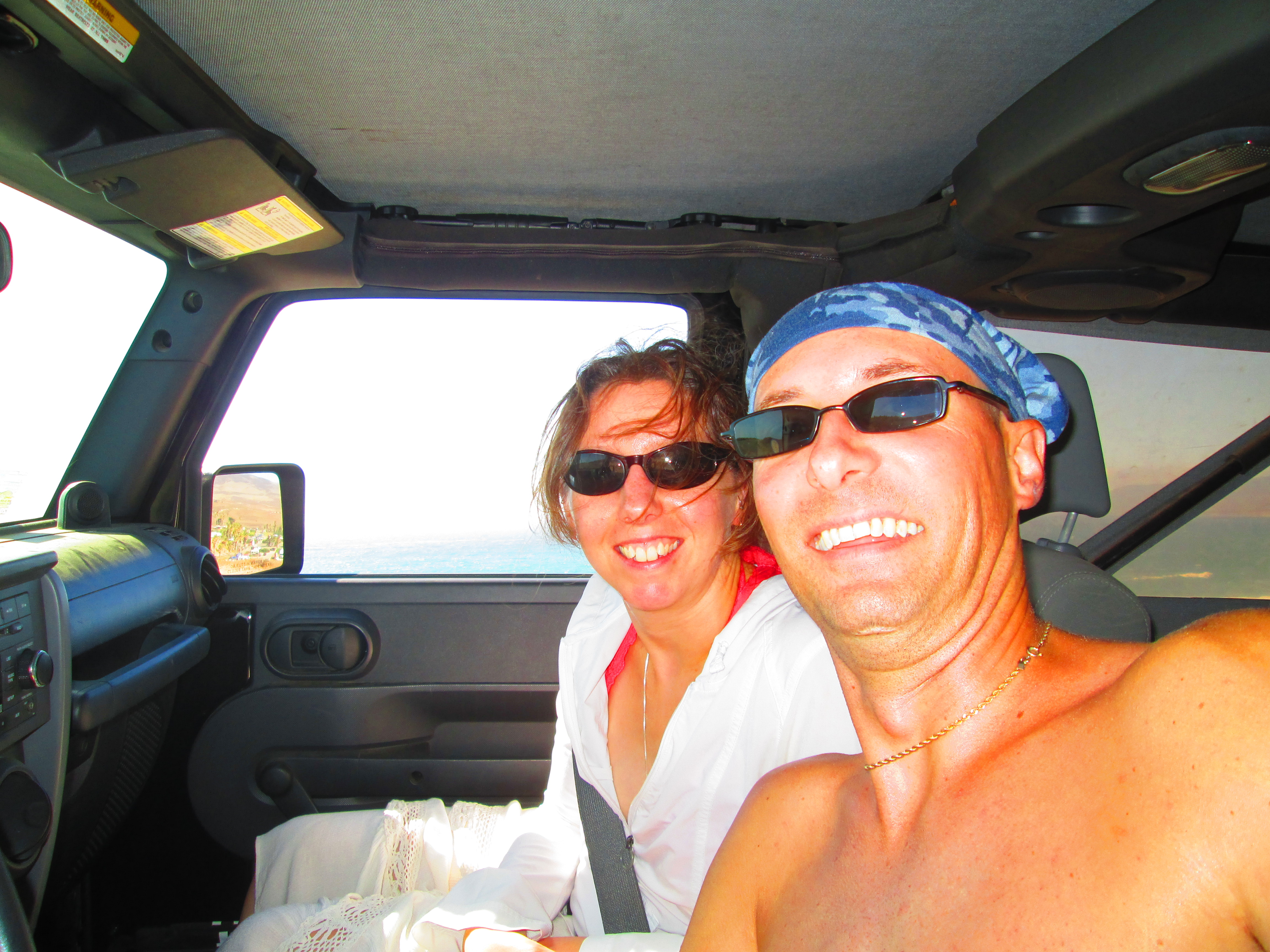
On the way back from Gaviota we passed a sign for the road to Jalama Beach. Chrysa has been really taken with the Pacific, and we got a text message from Aunt Debbie saying that we had to check out Jalama. Literally, all signs were pointing there.
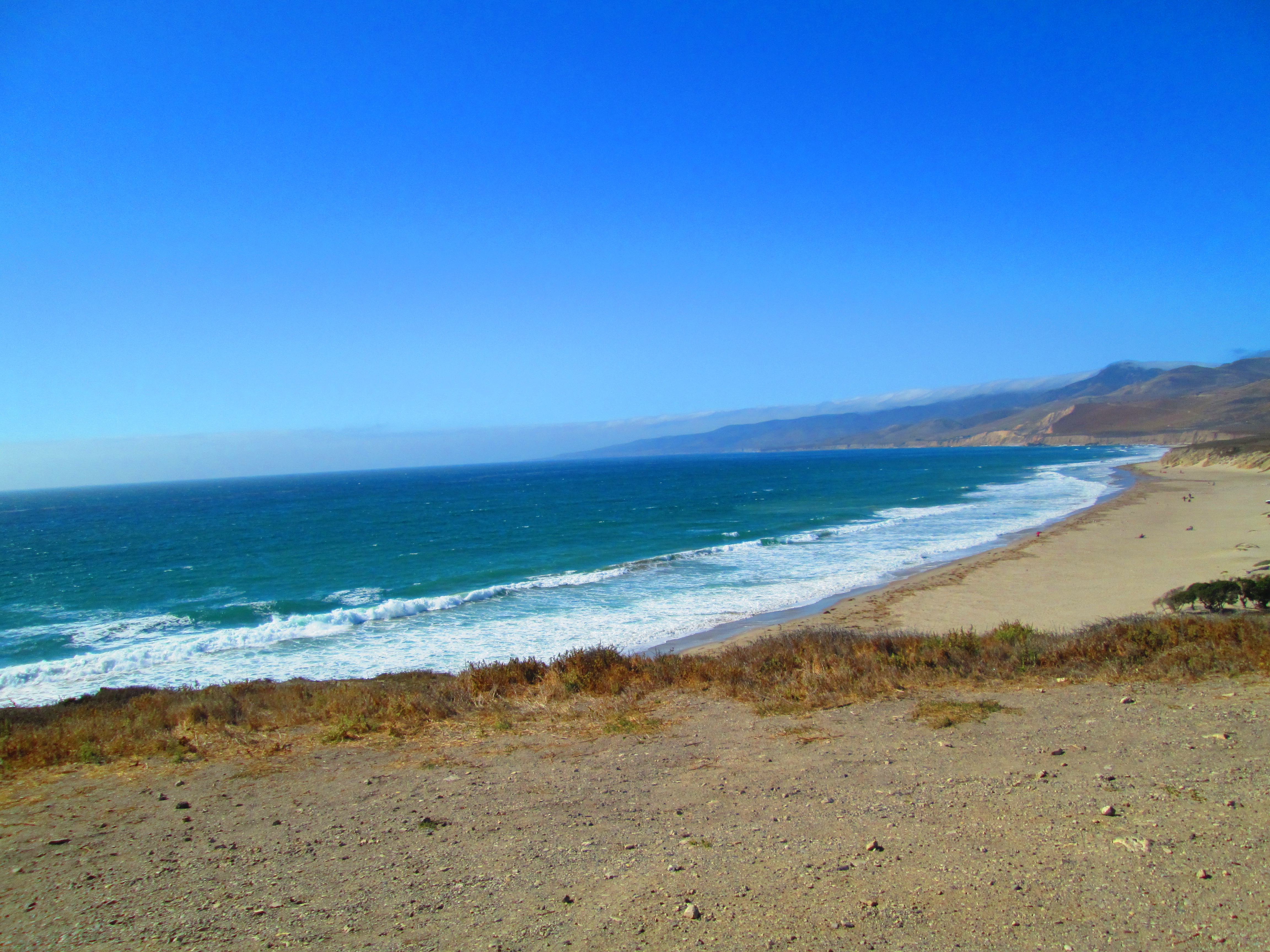
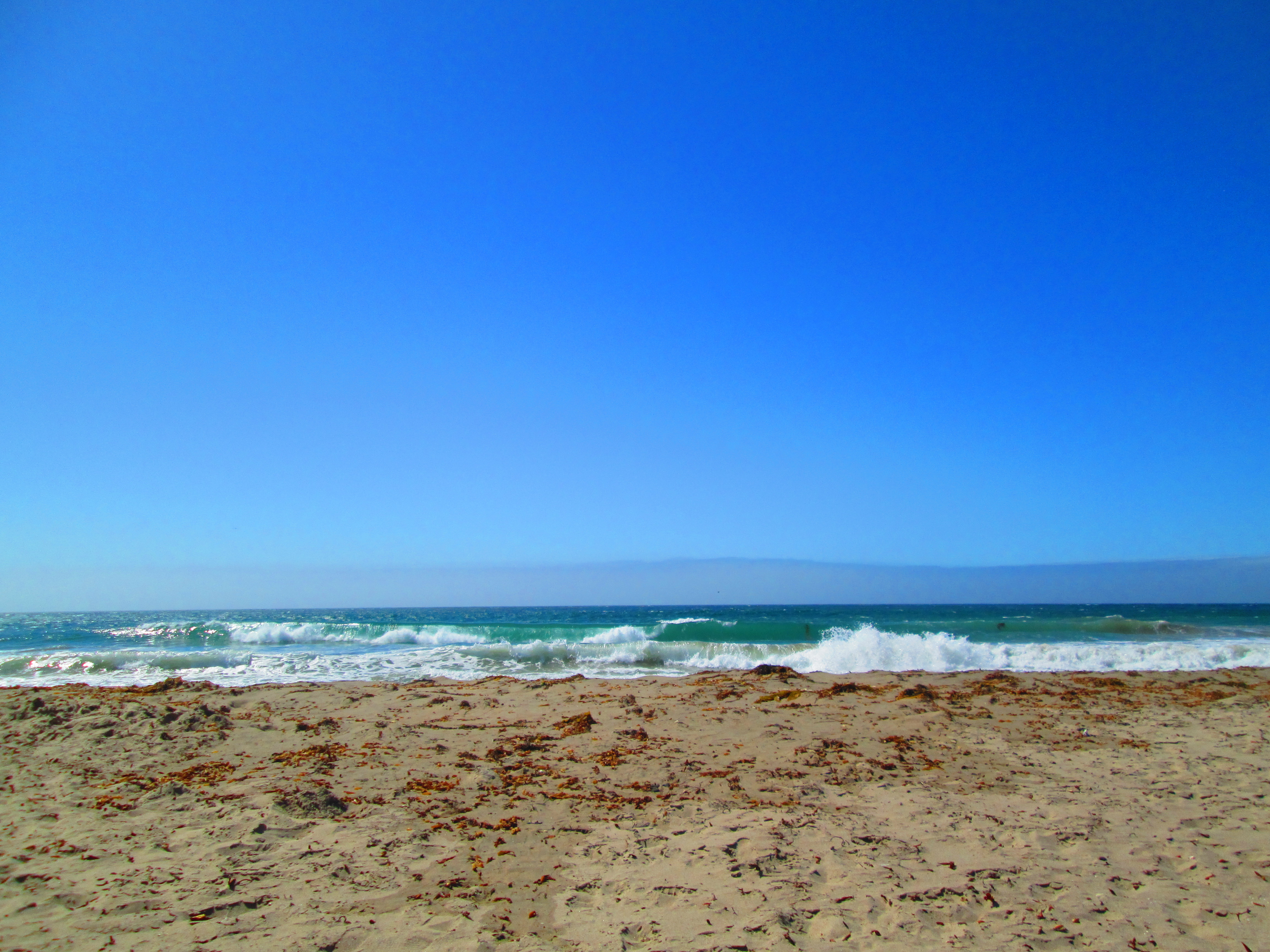
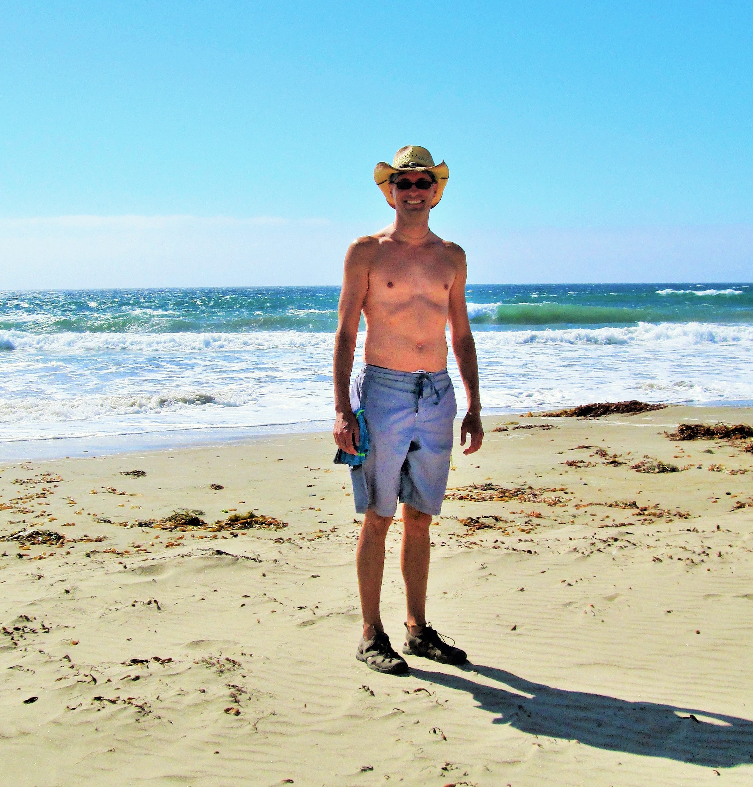
We were floored by the drive to Jalama. The road you take is twisty and hangs right off the mountains. Chrysa was grabbing the, “oh, shit” handles the whole way. The payoff is huge. The road ends at a state park that includes the beach, a very popular campground, and a general store, complete with a grill/restaurant. We spread out our blanket and proceeded to unwind. We took in the view while basking in the sunlight. People were flying kites, sunbathing, playing horseshoes, the usual stuff. There was even one guy kite boarding. Although I have wind surfed, I’ve never tried kite boarding. It looked like a lot of work but also a lot of fun. Like surfing, I’m going to have to give it a try while we are here.
![IMG_3533-1024x768[1]](http://www.wheretonext4us.com/wp-content/uploads/2015/10/IMG_3533-1024x7681.jpg)
After catching some rays, we decided to check out the general store. Both the internet and Debbie had recommended the burgers at Jalama. Chrysa and I were both hungry so we went in to check it out. The store is small and sells anything you would need for camping. While milling around the store were overheard people ordering food at the cash register. Chrysa and I each grabbed a can of beer, and ordered burgers from the cashier.
While waiting for our number to be called we sipped our beers and checked out the scene. It was a cool cross section of people. There were surfers, bikers, campers, and tourists all united by their hunger and love of a good burger. And what a burger it was! Nothing fancy, this was a straight up burger with lettuce and tomato, but they nailed it. The hamburger was fantastic. It was juicy and perfectly prepared. There is something magical about eating a perfect burger, on the beach, with no shoes on, while drinking cheap beer. I was in heaven. Eventually it was time to head home. I hope this trip to Jalama instills a love of the beach in Chrysa. I could get used to weekend trips like this.
![IMG_3536-1024x768[1]](http://www.wheretonext4us.com/wp-content/uploads/2015/10/IMG_3536-1024x7681.jpg)
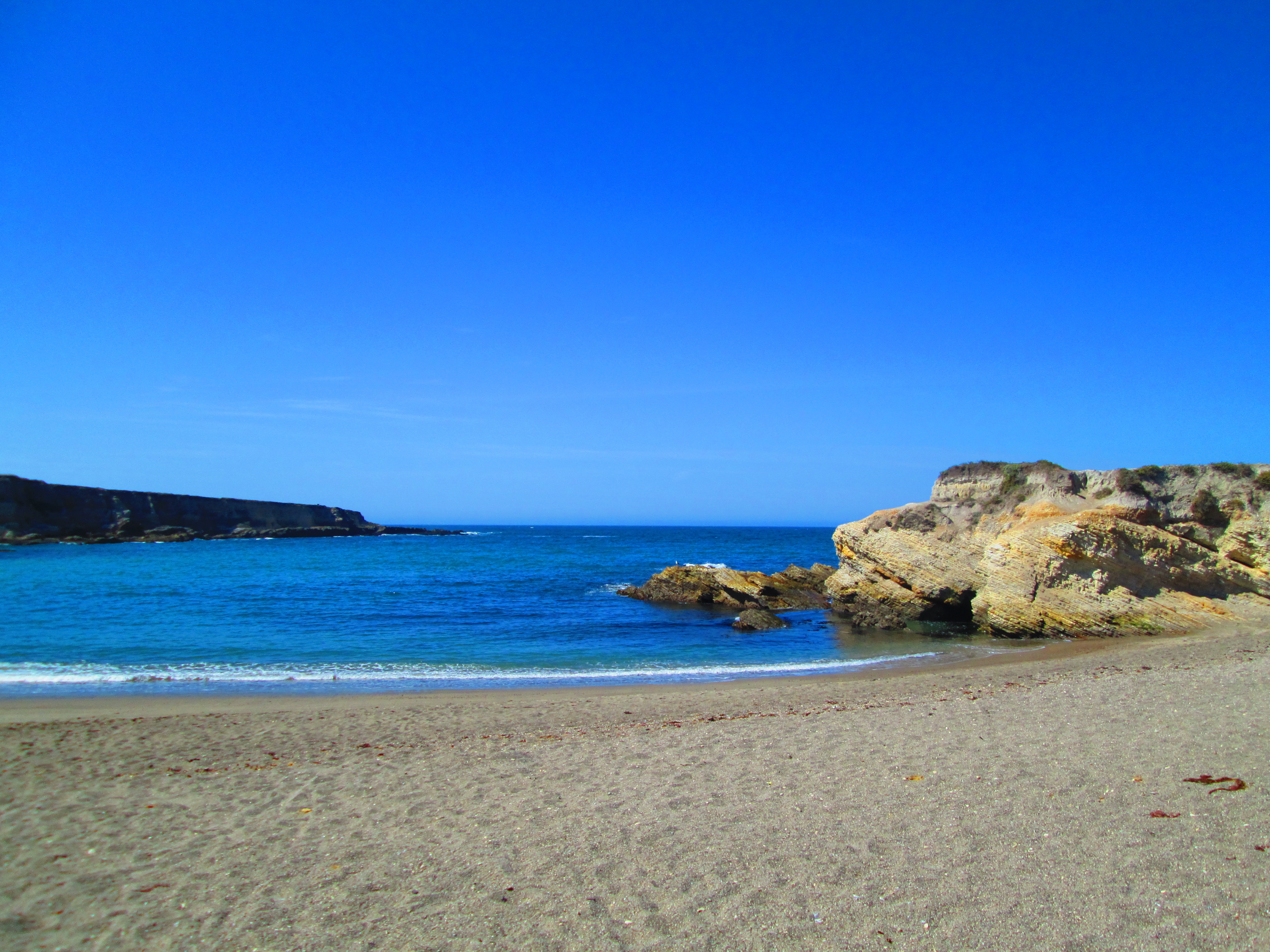
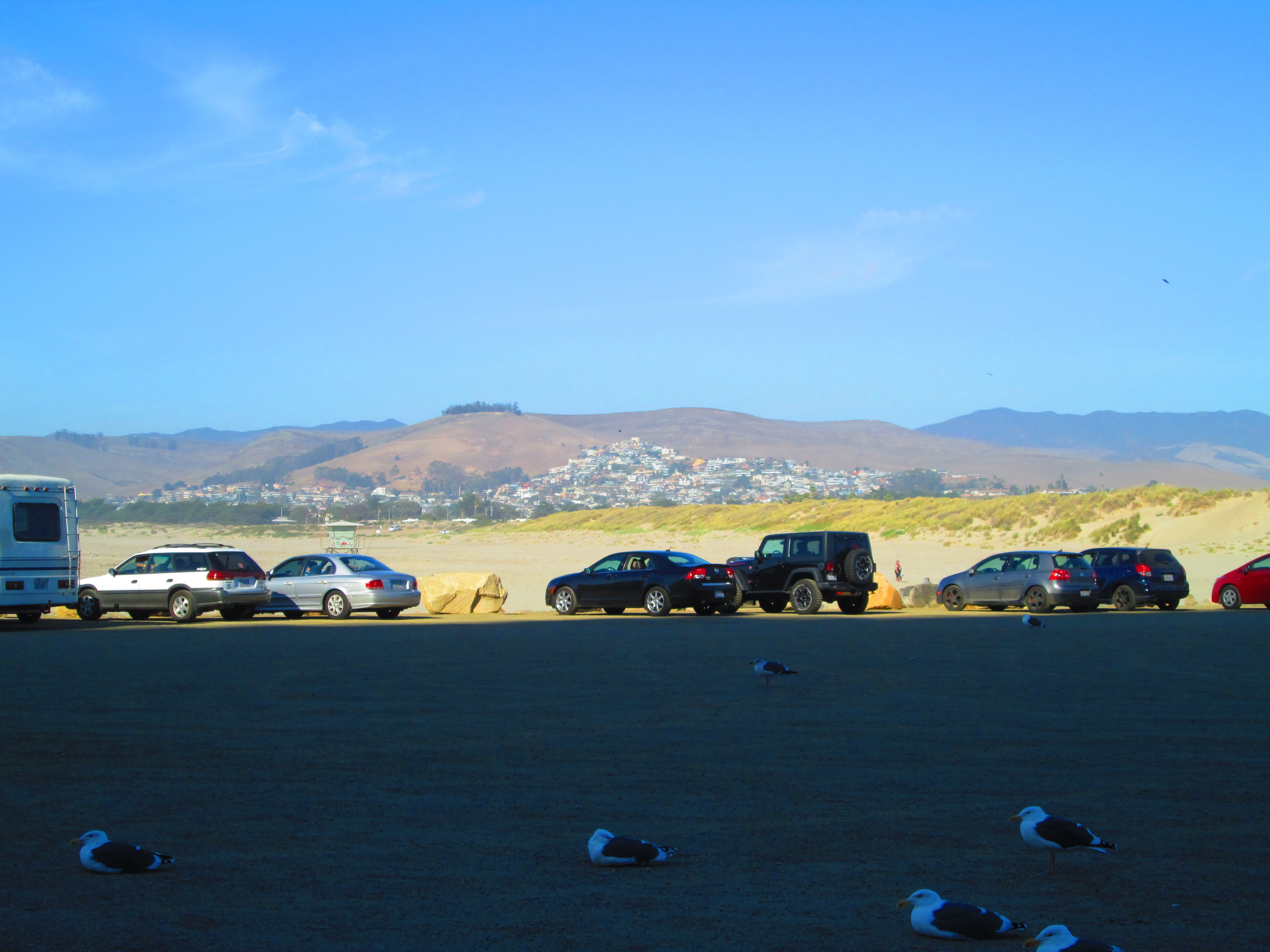
Now, Chrysa and I are obviously not afraid of a drive in order to get to a good payoff. One such payoff was Montana de Oro state park. Chrysa never did get her hike along the shore line while we were in Gaviota. We decided to remedy that issue by taking the hour and a half drive to Montana de Oro. The benefit of this particular park is the variety of terrain you can explore. There are mountain trails, tree lines trails, short and long hikes, and beach trails. It was the beach trail that was calling our name.
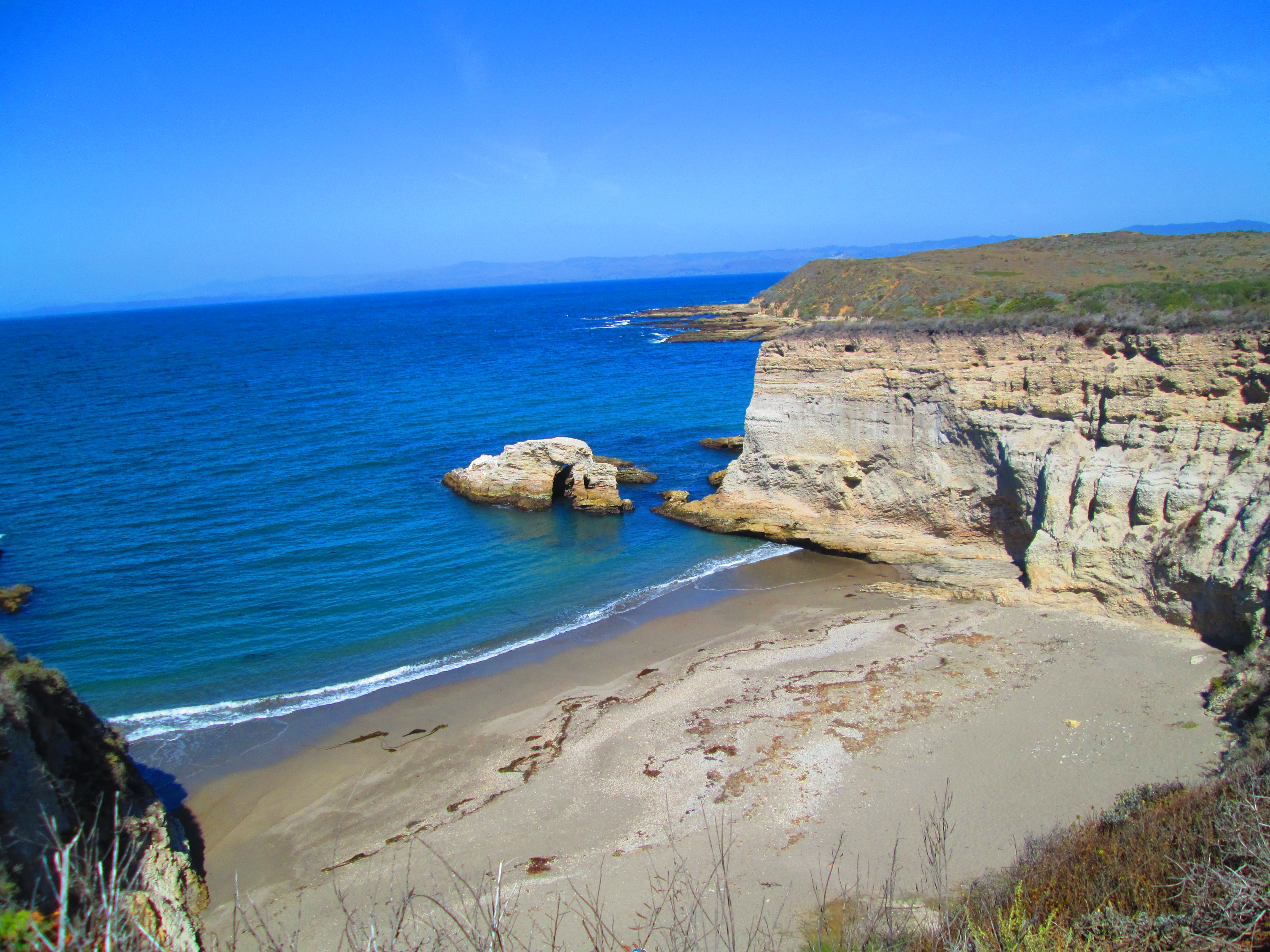
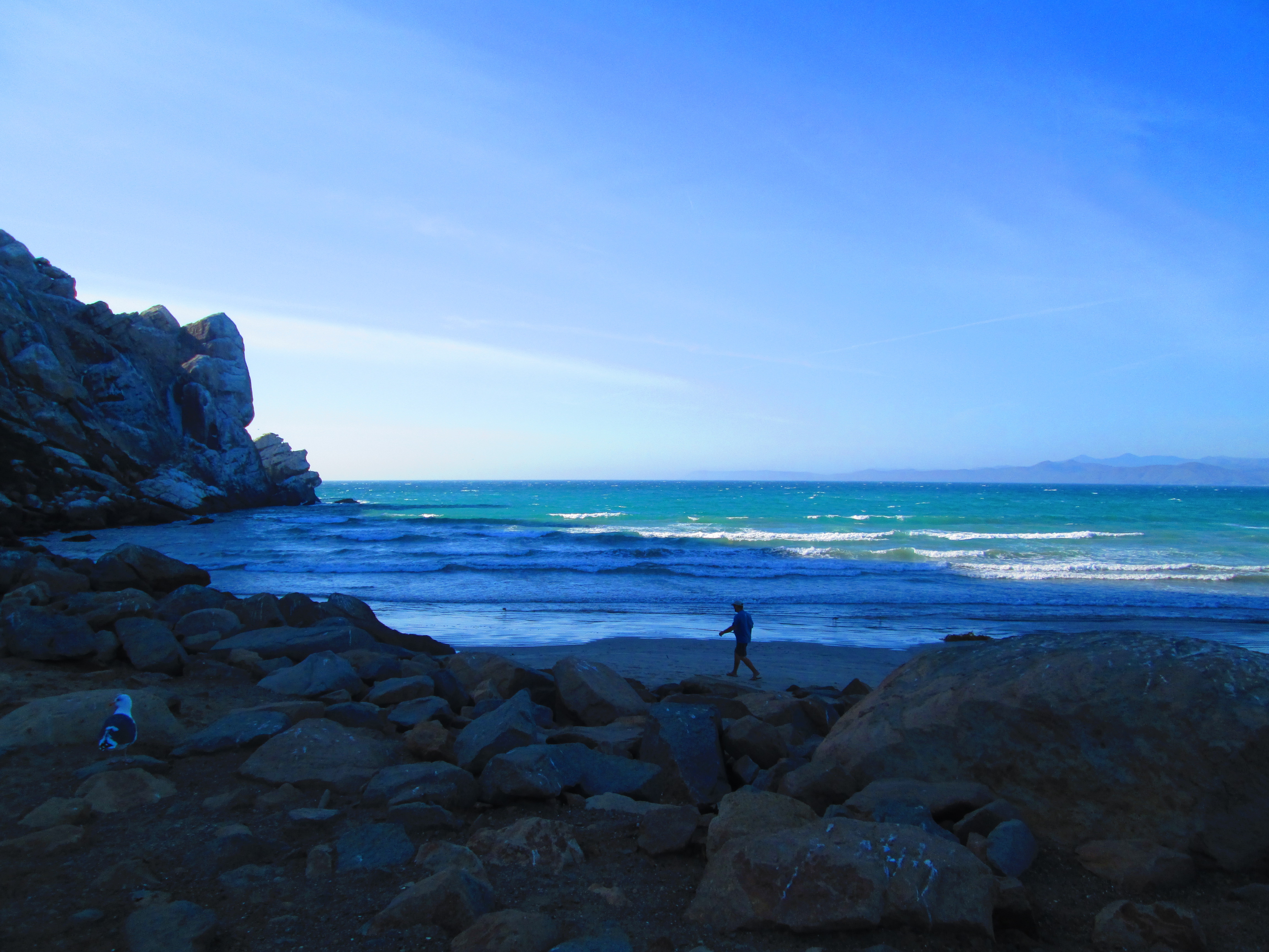
We drove deep into the park and immediately headed to the main cove. The view was stunning! It is a pristine bay surrounded by cliffs and beautiful rock formations. Chrysa and I explored the beach, climbed on the rocks and generally got our bearings. After a quick stop at the ranger station we settled on the bluffs trail that followed the coastline.
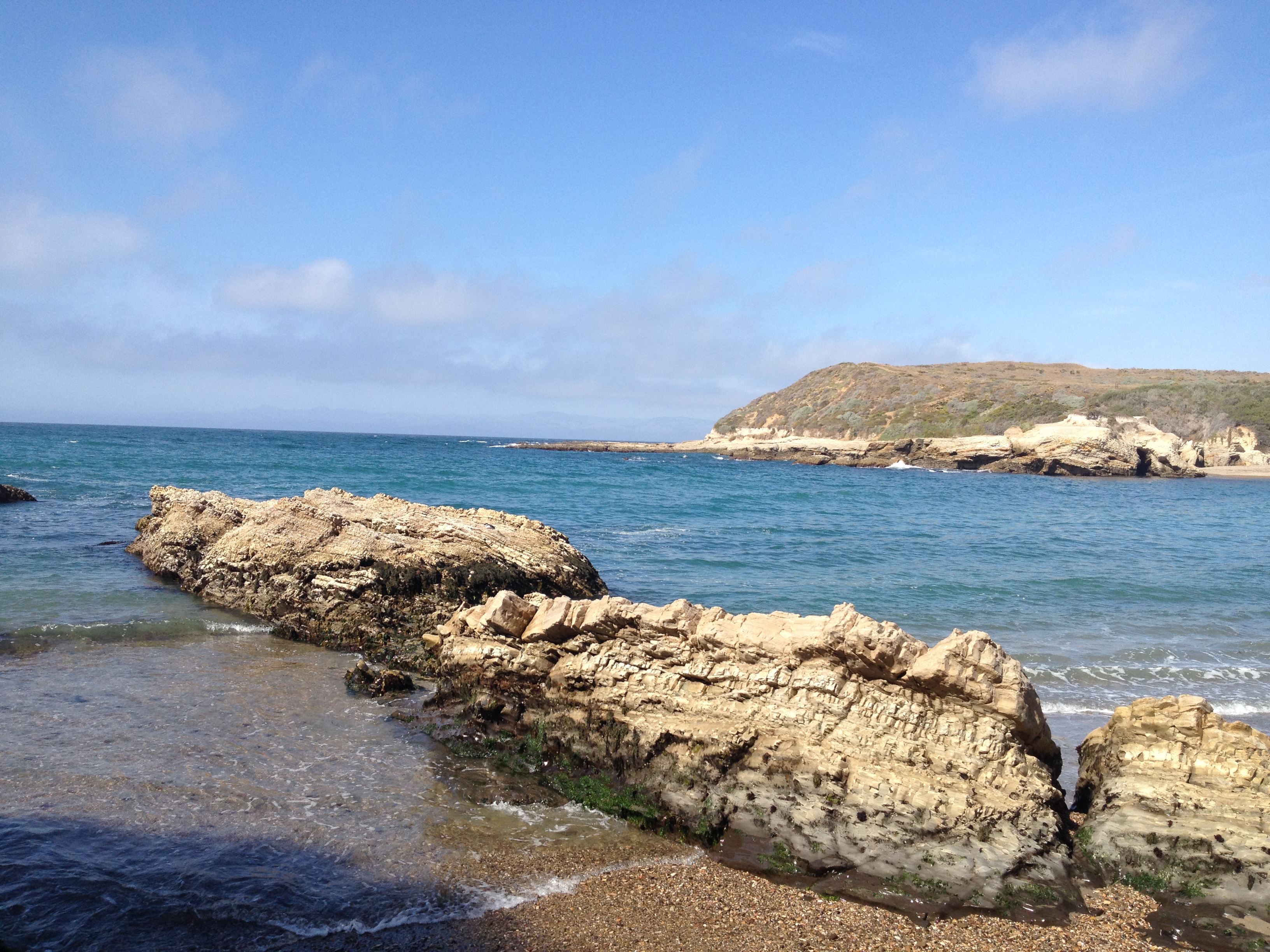
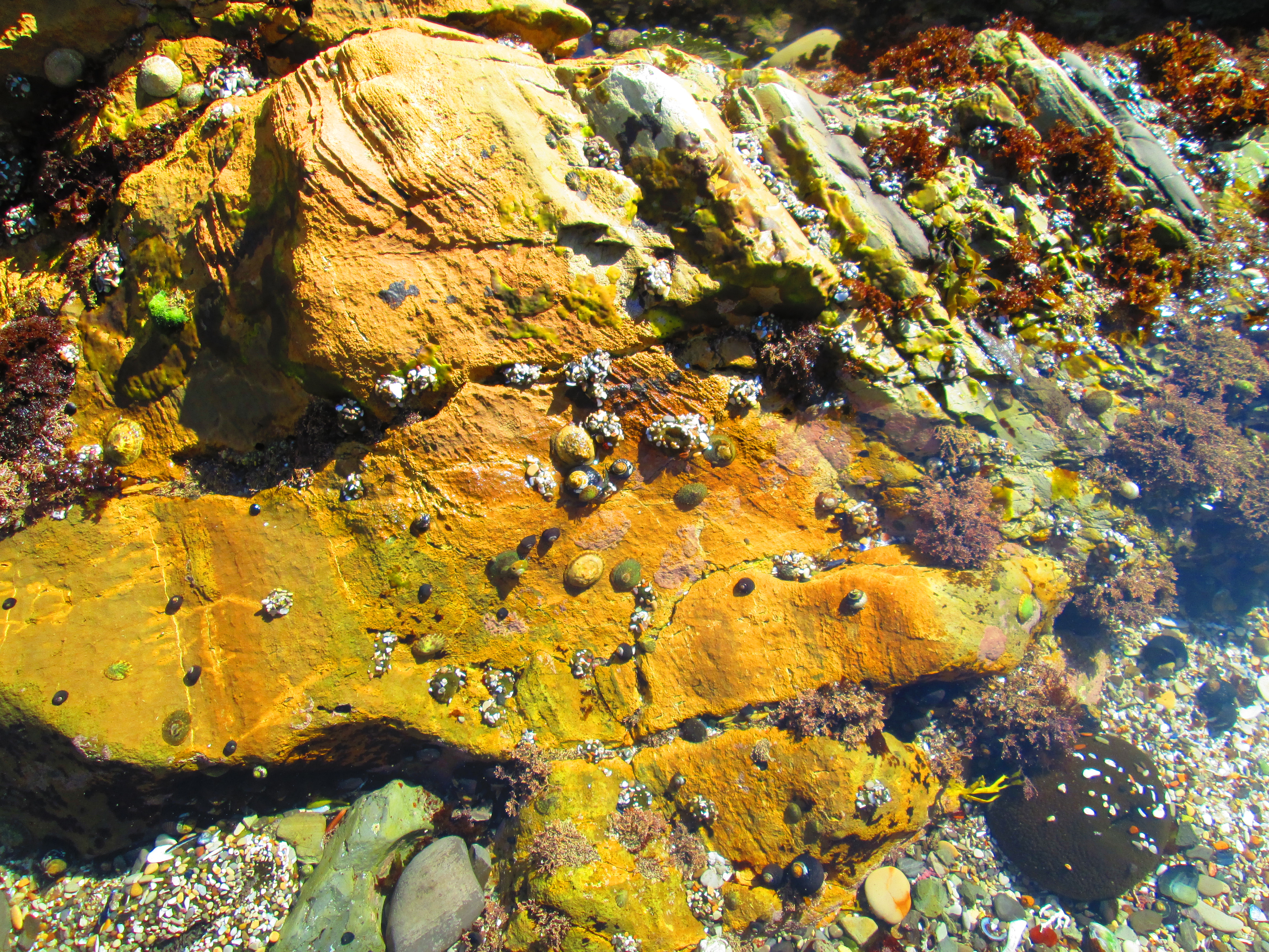
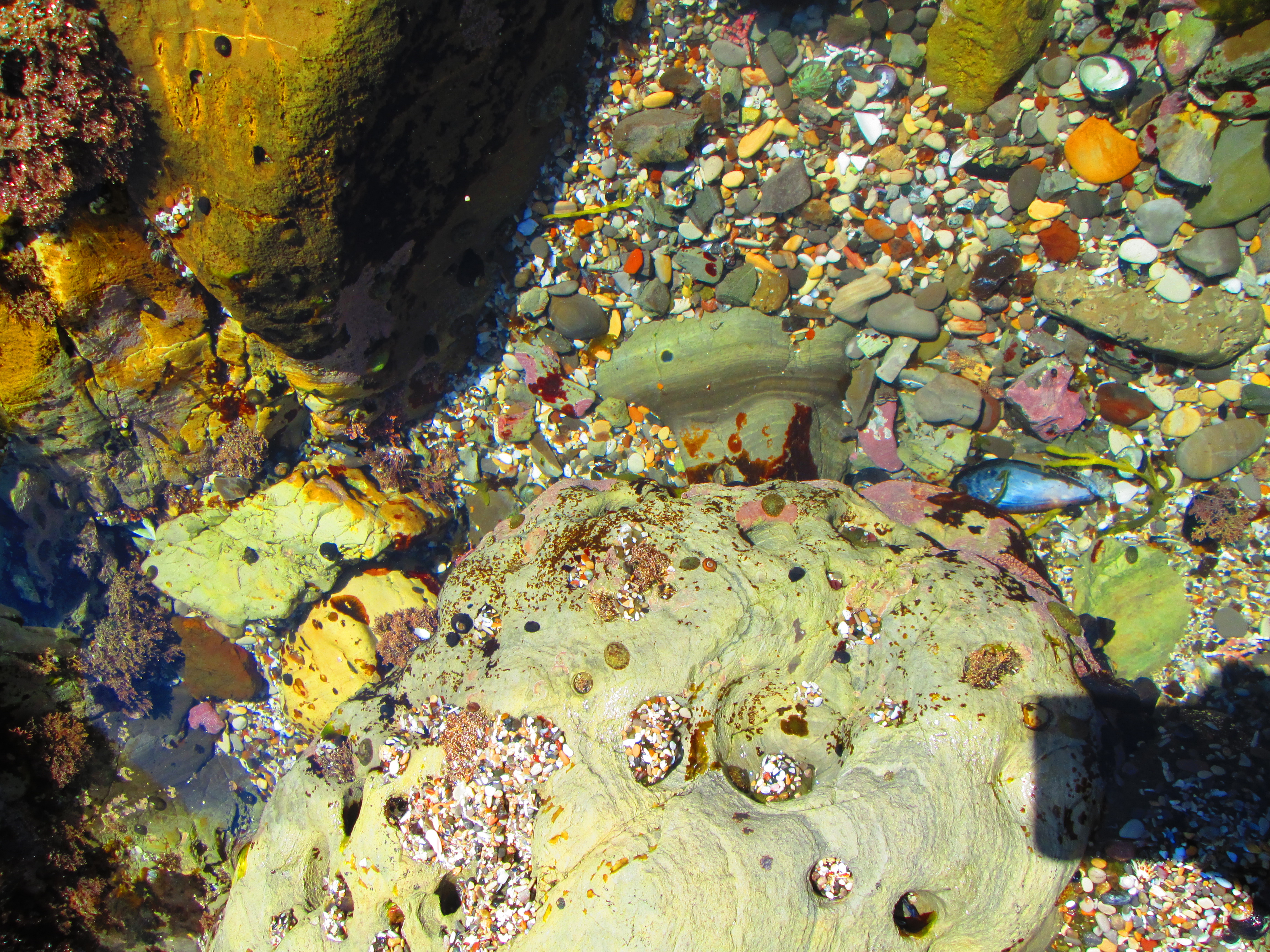
The hike was wonderful! The path was very easy to follow, flat, and had access points into all the coves along the way. We made sure to check out as many of the coves as we could. Each one was a little different. We took breaks from our hike by beachcombing. Chrysa’s ideal day at the beach is looking for pretty rocks and shells, and checking for little sea snails and crabs. Each cove gave her that opportunity.
![IMG_2747-1024x768[1]](http://www.wheretonext4us.com/wp-content/uploads/2015/10/IMG_2747-1024x7681.jpg)
![IMG_3553-1024x768[1]](http://www.wheretonext4us.com/wp-content/uploads/2015/10/IMG_3553-1024x7681.jpg)
![IMG_3556-1024x768[1]](http://www.wheretonext4us.com/wp-content/uploads/2015/10/IMG_3556-1024x7681.jpg)
![IMG_2738-1024x768[1]](http://www.wheretonext4us.com/wp-content/uploads/2015/10/IMG_2738-1024x7681.jpg)
![IMG_3554-1024x768[1]](http://www.wheretonext4us.com/wp-content/uploads/2015/10/IMG_3554-1024x7681.jpg)
![IMG_2737[1]](http://www.wheretonext4us.com/wp-content/uploads/2015/10/IMG_27371.jpg)
![IMG_2748[1]](http://www.wheretonext4us.com/wp-content/uploads/2015/10/IMG_27481.jpg)
We ended up walking for about two and a half miles before we turned back. Prior to departing we spent some additional time at the first beach area that we stopped at. We wadded into the water and just spent some time enjoying ourselves. While on the beach we decided to drive into the little town of Morro Bay for some dinner.
![IMG_2757-1024x768[1]](http://www.wheretonext4us.com/wp-content/uploads/2015/10/IMG_2757-1024x7681.jpg)
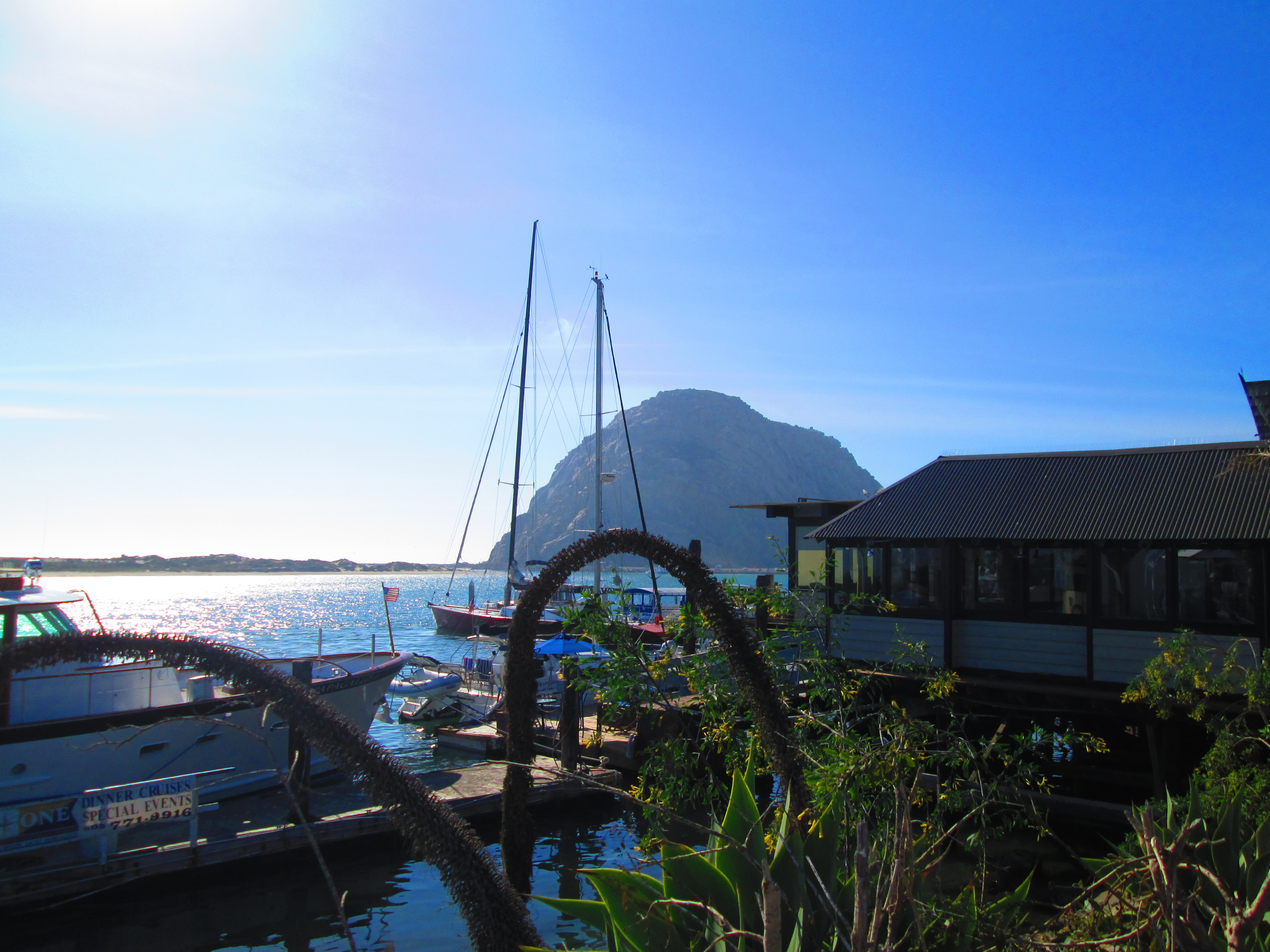
Morro Bay is a cute little town full of shops and cafés. The main feature of the town is the huge rock out in the bay. We could see the rock almost the whole way from Montana de Oro, and were happy to find out that you can drive right up to it. From the base of the rock we could see the town perch on the hills along the water. We also spotted seals in the bay, and a beach dude who had just finished spear fishing. He had speared 5 or 6 fish and he was going to have them for dinner. This was probably the most “California” guy I had ever seen.
![IMG_2767-1024x768[1]](http://www.wheretonext4us.com/wp-content/uploads/2015/10/IMG_2767-1024x7681.jpg)
![IMG_2768[1]](http://www.wheretonext4us.com/wp-content/uploads/2015/10/IMG_27681.jpg)
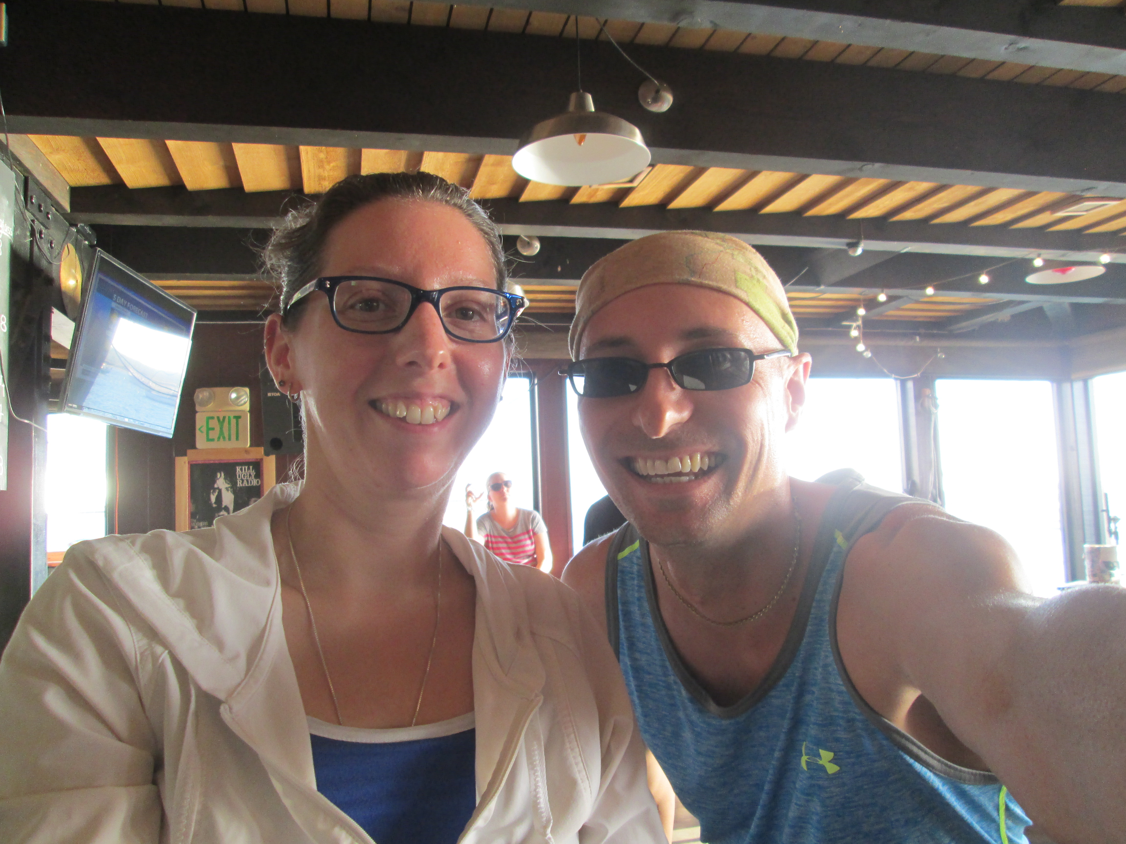
We made our way into town and ducked into a couple of the shops and generally explored. We got a tip on possible dinner locations and headed down to the waterfront to check them out. We ended up at a local brewery/bar that overlooked the bay. I ordered local clams and a local sour ale. We ate our food as the sun proceeded lazily toward the horizon. At some point during the meal Chrysa noticed that she had left her FitBit in Montana de Oro! We resolved to try and find it on the way home. But first – we bought a bottle of wine from a local shop.
![IMG_2771-1024x768[1]](http://www.wheretonext4us.com/wp-content/uploads/2015/10/IMG_2771-1024x7681.jpg)
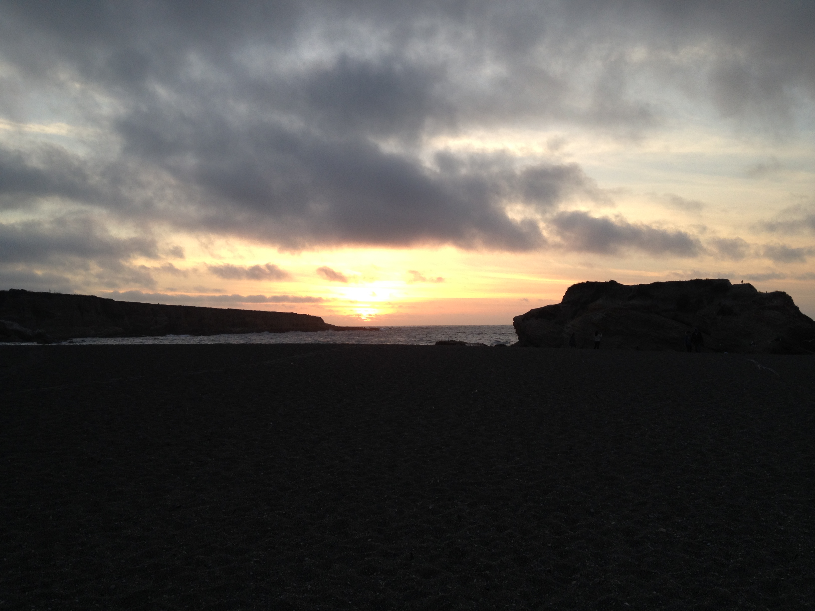
On the way back to Lompoc we stopped back at the park. Chrysa was convinced that she knew where the FitBit was, but we were ultimately unsuccessful. We did end up getting some good sunset pictures. In the end the FitBit was a small price to pay for a great day.
(155)